
Fighting Fire with Code: How Next-Gen Technology Is Transforming Wildfire Response

An Escalating Global Fire Crisis
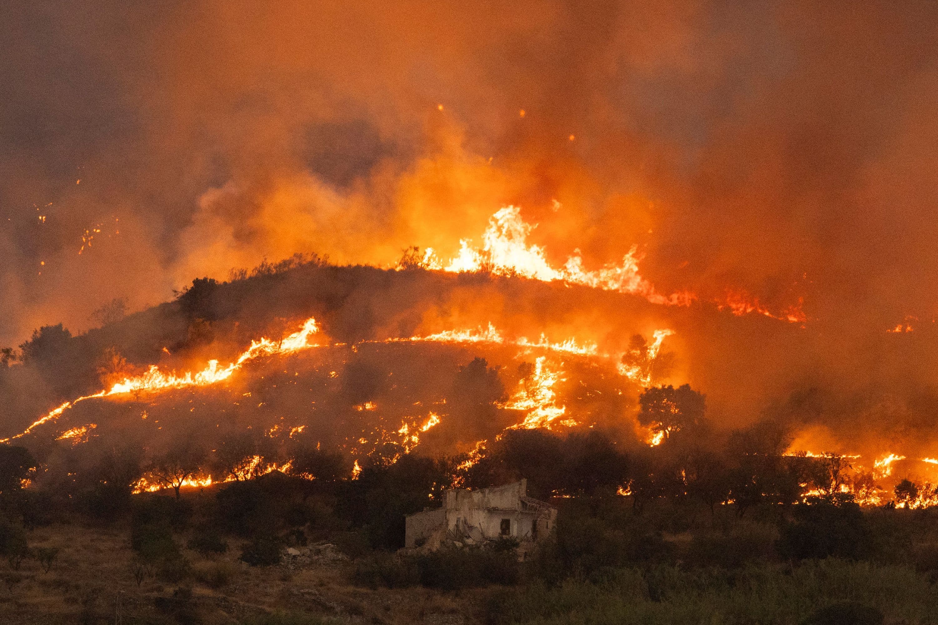
In recent years, summer seasons across Southern Europe—particularly in fire-prone regions throughout France and Spain—have been defined by devastating wildfires. Driven by record-breaking heatwaves, prolonged droughts, and dense vegetation dried out by shifting weather patterns, these blazes move faster, burn hotter, and cover far more ground than historical models ever anticipated. Firefighting teams on the ground are confronting unprecedented conditions where traditional tactics are frequently pushed past their operational limits.
When intense blazes ignite across mountainous landscapes or dense pine forests, manual detection and standard firefighting equipment face immense friction. Smoke can blind conventional aerial reconnaissance, steep terrain restricts vehicle access, and erratic wind shifts put human crews in extreme danger. As a result, public safety organizations and governments are recognizing that combating modern climate-driven fires requires a fundamental shift from reactive suppression to proactive, technology-enabled intervention.
To keep pace with the growing severity of these natural disasters, engineers, researchers, and tech developers are deploying a dynamic array of innovations. From autonomous aerial systems and predictive software algorithms to low-power environmental sensors, high-tech tools are becoming essential assets on the front lines of wildland fire management.
Drones and Autonomous Aerial Vehicles on the Front Lines
Unmanned Aerial Vehicles (UAVs) have emerged as one of the most effective tools for modern wildfire tactical teams. Unlike traditional piloted aircraft, specialized industrial drones can fly through thick smoke, operate safely at night, and navigate hazardous terrain without putting human pilots in harm's way. Equipped with thermal imaging cameras and multispectral sensors, these drones provide instant visibility into fire dynamics that remain completely obscured to the naked eye.
During active fire operations, UAVs fly high-precision routes to map out the exact perimeter of a firefront, pinpoint hidden hot spots smoldering under canopy cover, and track wind-driven spot fires before they spread. These unmanned systems serve as real-time intelligence nodes, streaming high-definition optical and infrared video directly to field commanders at mobile operations centers.
Beyond passive monitoring, advanced heavy-payload drones are also taking on active suppression roles. Specialized UAVs can drop precision payloads of retardant or deploy automated incendiary spheres for controlled backburns, building containment lines faster and safer than ground crews working under hazardous conditions.
Predictive AI and Real-Time Environmental Modeling
While physical hardware operates on the front lines, software and machine learning algorithms are transforming strategic decision-making in command centers. Predicting how a wildfire will move over the course of several hours requires processing massive amounts of variables simultaneously, including topographical slope, live fuel moisture, ambient air temperature, relative humidity, and dynamic wind gusts.
Modern predictive platforms leverage machine learning models trained on decades of historic fire data, high-resolution satellite imagery, and live weather station telemetry. By synthesizing these inputs in real time, AI engines can generate complex fire behavior simulations that project the likely path and speed of a blaze over six, twelve, or twenty-four-hour windows. This allows emergency responders to move evacuation notices ahead of time and position personnel along optimal defense lines before the firefront arrives.
Furthermore, satellite imagery augmented by computer vision algorithms can continuously scan vast geographical regions for thermal anomalies. Space-based sensors can identify tiny heat signatures long before human spotters or local residents notice smoke, dramatically reducing initial response times.
IoT Sensor Networks and Early Detection Systems
In dense, remote wilderness areas where satellite updates may suffer latency or resolution limits, Internet of Things (IoT) sensor networks offer continuous ground-level surveillance. Environmental sensors installed on trees, utility poles, or cellular towers constantly monitor atmospheric parameters, analyzing ambient air for minute changes in gas concentrations, micro-particles, temperature, and humidity.
Modern wildfire detection sensors use artificial intelligence at the edge to distinguish between ordinary dust or fog and the distinct chemical signature of wood combustion. When a sensor detects early off-gassing or thermal spikes characteristic of a nascent fire, it transmits an immediate alert via satellite backhaul or low-power wide-area networks (LPWAN).
By catching blazes during the initial smoldering phase—often within minutes of ignition—these ground-level IoT networks enable rapid local initial attacks. Suppressing a fire while it remains contained within a few square meters is exponentially easier, cheaper, and safer than attempting to halt a fully established crown fire running through tree canopies.
The Developer and Engineering Perspective
From a software and hardware engineering standpoint, developing tools for wildland firefighting presents unique technical challenges. Systems must be built to operate in high-stress, low-connectivity, and physically harsh environments. Engineers cannot rely on uninterrupted high-speed fiber or continuous 5G coverage when operating deep within remote forests or mountainous national parks.
This environmental constraint has driven significant innovation in edge computing and decentralized network architectures. Key technical pillars of modern emergency tech development include:
- Edge AI Computation: Processing computer vision and thermal analytics directly on drone onboard processors or local sensor node microcontrollers to minimize payload transmission size over constrained bandwidth.
- Mesh Networking Protocols: Deploying self-healing ad-hoc mesh networks so field sensors, drones, and crew handsets can communicate off-grid without relying on localized cell infrastructure.
- Open Geospatial Data Standards: Building interoperable data pipelines using formats like GeoTIFF and vector tiles so diverse software tools can seamlessly share spatial boundaries across local, regional, and national emergency response platforms.
- Robust Hardware Design: Engineering ruggedized enclosures capable of surviving ambient temperatures that spike rapidly, alongside water, dust, and smoke exposure.
Implementation Challenges and Operational Hurdles
Despite the immense promise of modern firefighting technology, rolling out these tools at scale across multiple jurisdictions presents notable challenges. Institutional adoption can be slow, as public safety organizations must balance the promise of new technology against rigorous testing and reliability standards. Equipment must work flawlessly when life and safety are on the line; software bugs or hardware failures during an active disaster carry unacceptable consequences.
Interoperability remains another major hurdle. Fire agencies across different regions or countries—such as neighboring European states responding to cross-border emergencies—often rely on disparate communications networks, proprietary software systems, and differing operational protocols. Integrating data streams into a unified operational picture requires ongoing international collaboration, standardized data formats, and shared training frameworks.
Additionally, funding disparities between large national emergency services and small rural fire departments create uneven technological capabilities. Ensuring that high-risk rural communities have access to early detection systems and modern mapping tools requires sustained public investment and long-term infrastructure planning.
Building a Tech-Resilient Future for Emergency Response
As extreme weather events become more frequent and severe across regions like Europe, North America, and Australia, technology will play a central role in mitigating disaster outcomes. However, technology alone is not a complete silver bullet. The most effective wildland management strategies will always combine cutting-edge tech with traditional forestry management, land maintenance, public awareness, and the specialized expertise of human firefighters.
What technology offers is an unprecedented force multiplier. By pairing spatial data, predictive AI, autonomous robotics, and continuous sensor monitoring, emergency agencies gain crucial time—the single most valuable commodity when confronting a fast-moving firefront. As these systems continue to evolve, the integration of smart tools will undoubtedly save human lives, protect property, and shield vulnerable ecosystems from the devastating impacts of climate-fueled wildfires.
Source: wired.com